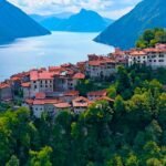
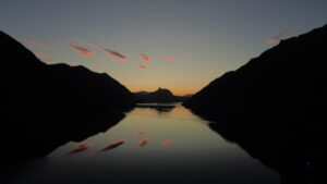
There is a rare geography, on the Como side of the Lake Ceresio. In less than nine kilometers as the crow flies the altitude goes from 271 meters of the lake to 2,245 of the Gino's Lace: nearly two thousand meters of elevation gain in the span of a map. The Italian-Swiss border is a constant presence: it runs along the high ridges, crosses the transhumance passes, and grazes the shores of Lake Gandria.
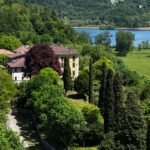
And in between, five valleys that have maintained distinct physiognomies — Cavargna Valley, Rezzo Valley, Valsolda, Intelvi Valley, Sanagra Valley —for hydrography, dialect, architecture, crafts, and altitude. For those who enjoy active tourism, this isn't a lake to be hurriedly circumnavigated between breakfast and aperitif. It's a sprawling park, a system where walking, running, sailing, cycling, and climbing to altitude aren't activities to be consumed, but a natural way of experiencing the landscape. And it's also one of the few corners of the Lombard Prealps where the pressure of mass tourism hasn't yet obliterated the slow pace—precisely because here, as we've always said, the best way to discover Lake Ceresio and its valleys is to have no fixed schedule.
If you have a week, a weekend, or even just a free morning, here's what Ceresio Outdoor has to offer.
On foot: thematic trails and valley walks
The portal's hiking trails—all available online with technical data, photos, and downloadable GPX tracks—cover difficulty levels ranging from family walks to multi-hour ridge traverses. What they have in common is that they aren't simply sports trails: they are thematic routes, narrative trails that interpret the landscape through a profession, a memory, a historical figure.
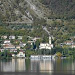
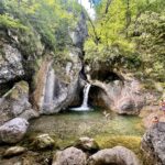
La Walk of the 9 Bell Towers It's the simplest way to start: a ring that touches the bell towers of the hamlets and restores, in a few hours, the texture of a territory made up of scattered nuclei. Via del Ferro between Carlazzo and San Bartolomeo Val Cavargna It retraces a stretch of the ancient cross-border road along which, for centuries, the iron mined and processed was transported between the Cavargna Valley and the Swiss Morobbia Valley—a steelmaking activity that can be traced back to the 8th century. Along this stretch, you can still find vestiges of that era: the water-powered hammer of Ponte Dovia, the votive chapels of Sora, before the climb to San Bartolomeo. Those seeking a more naturalistic setting will find the path that leads from Gottro to Rogolone, the monumental oak which is one of the symbols of the area, or the walk from Claino towards Saint Julia, overlooking the lake. The Valsolda Regional Forest and the Tour of the Valsolda Hamlets they complete a picture in which each path has a reason beyond the difference in altitude.
You can find them all, with difficulty, length and downloadable track, in the section Routes of the portal.
Running: the valley paths seen on the run
There's a way to experience these trails that Lake Ceresio has rarely explored: running. The paved mule tracks, the hillside paths, and the trails connecting the valley hamlets are ideal terrain for trail running and running in nature, far from traffic and concrete. It's an activity particularly suited to the Swiss and German public, accustomed to seeking technical yet clean trails, at altitude yet accessible.
Almost all of the walking routes on the portal can also be read as a running route: just adjust the pace and elevation gain to your own legs. And every year, at the beginning of summer, Porlezza hosts the Experience Porlezza on the Run, a well-established road race that brings runners from both sides of the border to the town.
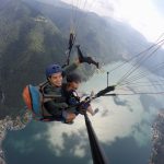
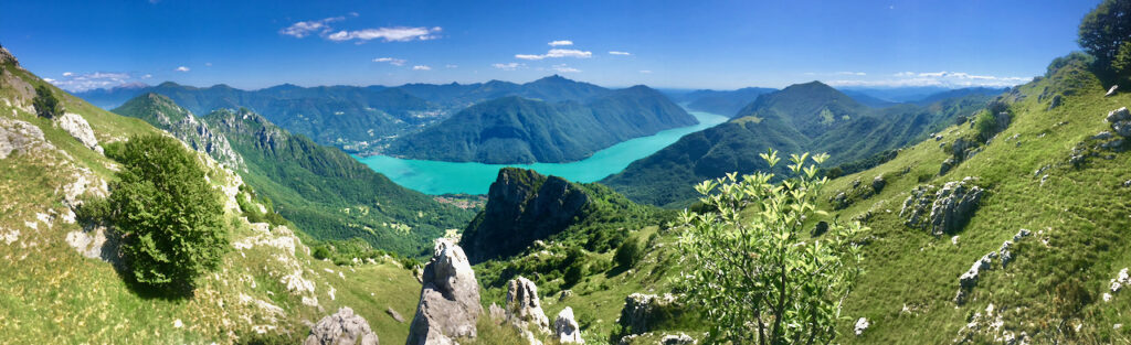
At high altitude: from the lake to the border peaks
Above the woods, Ceresio becomes a real mountain. Gino's Lace, with its 2,245 meters, is the peak that dominates the entire basin: its ascent, from the valley floor to the border ridges, is one of the most complete climbs in the area. Not far away, the Mount Garzirola, 2,116 metres, offers views that range from the Alps to the plain, along the ridges that once marked the routes of transhumance and smuggling.
These are itineraries for trained hikers, requiring the right equipment and checking the weather forecast before setting out. In return, they offer what the Ceresio valleys offer best: silence, expanse, and the rare sensation of being in a place that hasn't yet been explored. The ascent plans for Pizzo di Gino and Monte Garzirola are in the section Routes.
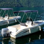
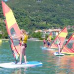
On the water: by canoe, kayak and by fishing line
Lake Ceresio isn't just about exploring on trails: it's also about exploring from the water, with a paddle. Kayaking, canoeing, and stand-up paddleboarding offer a different perspective on the lake and its shores, from the sheltered northern sector between Porlezza and Claino con Osteno to the Valsolda coast. It's a slow and quiet way to explore, but it requires knowing where to paddle, where to rent equipment, and how to stay safe on the water.
There is another water activity that has a long tradition on Lake Ceresio: sport fishing. To fish in the Lombardy waters of the lake, you need a Type B License from the Lombardy Region, which costs €23 per year and is also valid for foreign tourists, eliminating the need for a separate tourist permit. Children under 18, over 65, and people with disabilities pursuant to Law 104/1992 are exempt. A day on the lake with a rod, at dawn, is one of the oldest and most peaceful ways to enjoy these waters.
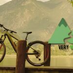
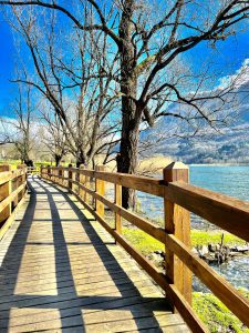
On two wheels: the cycle/pedestrian path and the paths
On the two-wheel front, the symbolic route is the cycle/pedestrian path connecting Porlezza to Lake Como, a flat and safe trail, suitable for families, which runs along the valley floor and touches the Piano Lake Nature Reserve, with its reed beds and wildlife. It's the most relaxed way to cycle in the area, accessible even with children and rental bikes.
Those seeking more challenging terrain will find a network of mule tracks and forest roads in the valleys, ideal for mountain biking and e-biking, with significant elevation gains and views that make the effort worthwhile. The local rule applies here too: climb slowly, pay attention to where you put your bike, and the landscape does the rest.
The rhythm of the active season
The calendar of Lake Ceresio and the Valleys is not made up of large-scale mass events, but rather of local events that follow the rhythm of the seasons. During the warmer months, guided excursions to the Lago di Piano Reserve and the Valsolda Regional Forest abound, as do non-competitive walks organized by the Pro Loco, and activities in the Porlezza Nautical Club on the water and, every now and then, sporting events that combine hard work and boarding, two things that always go together around here.
To find out what's on now, please refer to the page Events of the portal, updated as programs are confirmed. It's there that Ceresio's active season takes shape, event after event.
A different way of being in the territory
Walking, running, cycling, paddling, climbing: on Lake Ceresio and its valleys, these aren't just ways of "doing sport," they're ways of being in a place. Slower, deeper, further away from the circuits of mass tourism. This is the idea that has driven Ceresio5Valli since the beginning—a territory to be experienced, not traversed.
If you come and take home a photo that tells the story of one of these days, share it with us on social media: we'll publish the best ones on our channels.
To plan your visit: Itineraries and routes · Events on the calendar · Services and rentals · Where to sleep · Public transport